A Day at the Bay

St. Michael's collage

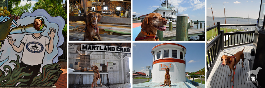
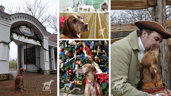
Glimpses from around the 18-acre campus of the Chesapeake Bay Maritime Museum in St. Michaels, Maryland. Clockwise from left: a) Goofing around with the cut-outs in front of the museum; b) In the boat building workshop; c) Surveying the shoreline with the Hooper Strait screwpile lighthouse in the background; d) A tasty view of the harbor from atop the 1879 lighthouse; e) Catching some rays on the pilothouse of the buy boat Thor; f) Exploring the history of Maryland’s crab fishing industry.

It was a beautiful spring day, and we decided to head to Maryland’s eastern shore to do some exploring in St. Michaels, a town known for its Chesapeake Bay breezes, traditional Maryland fare (think:  blue crab and Smith Island cake, which are the official state crustacean and state dessert, respectively), and history (more about that later). To reach St. Michaels, you head for Annapolis which is a pretty snazzy dog-friendly stop in its own right, go over the Bay Bridge, and about 50 miles later (less than an hour, if the traffic gods are smiling upon you) wind up at your destination.

We didn’t set out with a real plan this time other than to savor the sights, the day, and okay…maybe some crab cakes. We followed Route 33/Talbot Street about a half mile into St. Michaels’ downtown and turned right to park in the Chesapeake Bay Maritime Museum’s lot.

Tavish at the Chesapeake Bay Maritime Museum

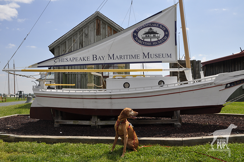
What!? Chesapeake Bay Maritime Museum is dog-friendly. How cool is THAT?!

We of Team Tavish were trying to figure out where along the fence line was the best spot to photograph Intrepid Pup Tavish with the museum’s signature lighthouse in the background, when…. whaaaaat?? Wait. A. Minute. Just on the other side of the fence we spied a Mutt Mitt Dispenser! You wouldn’t have one of those planted there if dogs weren’t welcome, right? So we stopped into the museum’s Admissions Building and inquired.  “Yes, of course!” the visitor services attendant replied. “You’ll need to keep your dog on a leash and clean up after him, but otherwise he’s allowed anywhere on the campus, except in buildings that have carpeting.” With that, we happily shelled out our entry fees (Tavish was free) and ended up spending nearly three hours there!

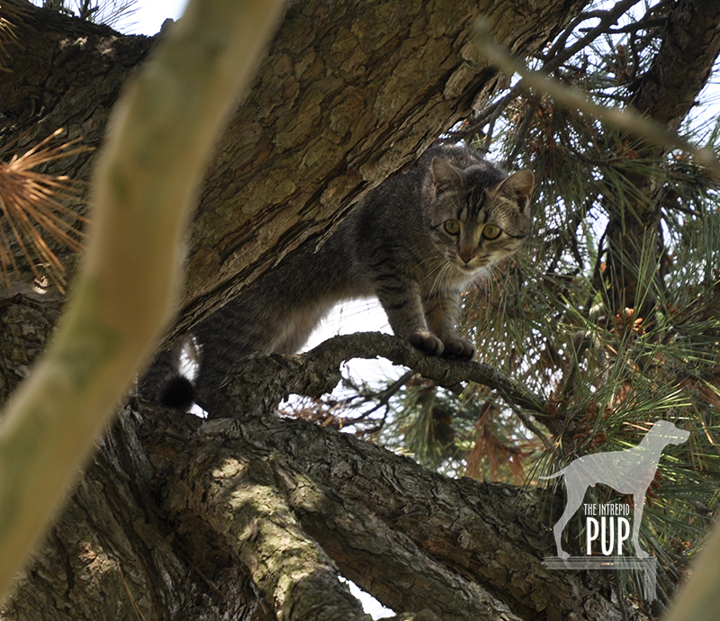
The museum was a real treat:  unexpectedly dog-friendly and far more extensive than we’d imagined. There were only four carpeted pavilions Tavish couldn’t go into. For those, we just took turns while one of us waited outside with Tavish, who did his share of rolling in the grass and watching the passing boats. Tavish even spied a beautiful tabby keeping an eye on us from a scrub pine. We later learned she’s a former stray who is now the museum’s resident salty boatyard cat, Ms. Edna Sprit! As for places Tavish COULD venture into, there were many! We wended our way through the Small Boat Shed housing the nation’s largest collection of Chesapeake Bay watercraft. We explored a dredgeboat to learn all about oystering and clambered out on the wharf to the working waterman’s shanty, where we got to check the eel pots and clumsily experiment with using oyster tongs.  And a real highlight was navigating a narrow spiral staircase and crawling through a hatch to reach the top of the 1879 Hooper Strait Lighthouse!

Tavish with Chesapeake Bay Retriever

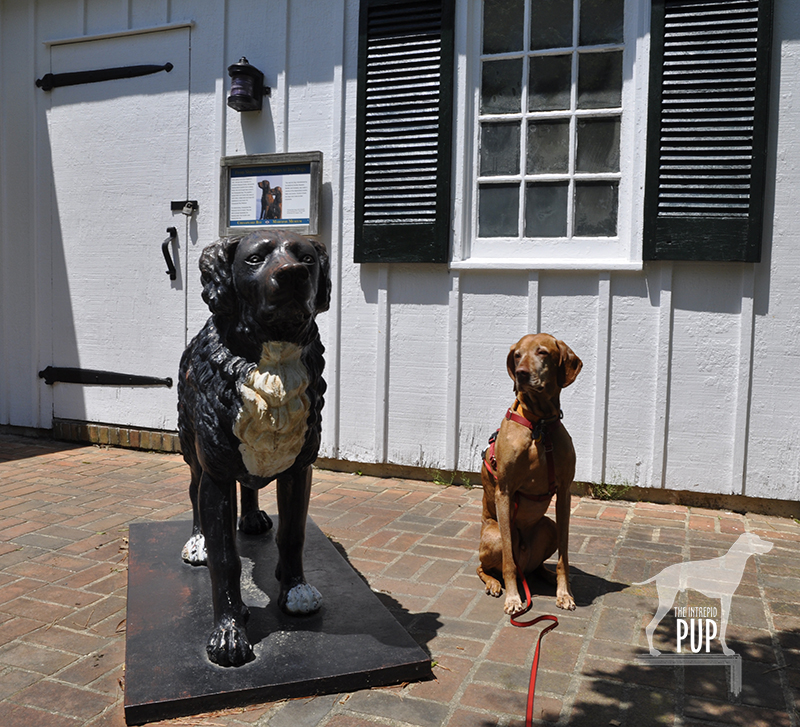
An homage to Maryland’s state dog: Tavish sizes up this cast iron statue of a Chesapeake Bay Retriever outside the “Waterfowling” pavilion.

A bonus for dog lovers is the museum’s waterfowling exhibit chronicling a key element of bay heritage. While Tavish couldn’t partake of the fascinating display of hand carved duck decoys and tools of the trade, there was a stolid cast iron Chesapeake Bay Retriever statue outside with an interesting story (see photo at right).  It just so happens that in 1807, Marylander George Law was sailing home from England aboard the Canton, when he intercepted a sinking British vessel and rescued its crew and two Newfoundland puppies. When Law arrived safely at port, he purchased the puppies from the captain and brought them home. He named the male Sailor and the female Canton. Since Law ultimately had to go back out to sea, he gave the dogs to two men who allowed them to breed with local dogs, probably coonhounds. Their progeny had dense dual coats, took exceptionally well to the water, and were prolific in their versatility and ability to retrieve waterfowl. The Chesapeake Bay Retriever as a breed was born, and in 1964, it was recognized as Maryland’s official state dog.


Click to see what 2 on the Wag-A-Meter meansDogging the Details

 38°47’14.35″N,  76°13’13.73″W
Chesapeake Bay Maritime Museum
, St. Michaels, Maryland

St. Michaels ranks a “2” on the Intrepid Pup’s wag-a-meter for being exceptionally dog-friendly and offering plenty to do for pup and person alike.


Tavish at the Crab Claw Restaurant

Hmmm. . . lobster I’m familiar with from living in Maine. You? Not so much!

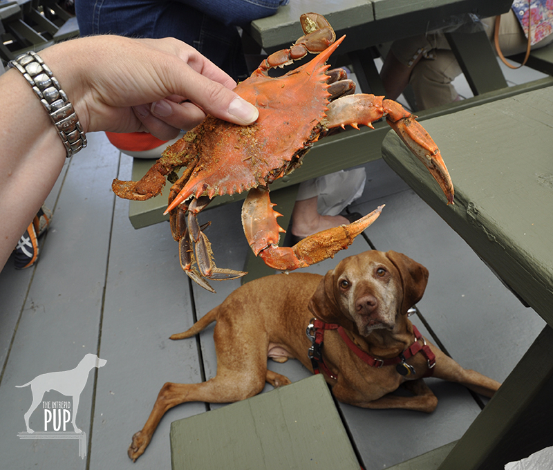
If you’re spending the day in St. Michaels, you’ll need to grab a bite to eat, and fortunately there’s a quintessential Maryland-y option that’s also dog-friendly: The Crab Claw Restaurant. This is definitely fair-weather casual dining, because with your pup in tow, you’ll be eating outside on the partially covered, spacious deck. Be prepared to wait a bit for your picnic table, since lots of people will have this very same idea on sunny weekends. It’s worth it, however, for the good food and spectacular view of the bay. Truth be told, the people-watching is equally entertaining, as folks pull up in boats of all shapes and sizes. After noticing a young couple a few tables away too full to finish off their dozen crabs, we decided to order the less messy and labor intensive option: crab cakes. Tavish was acting particularly winsome that afternoon, and it wasn’t long before the woman from the couple came over to pet and take pictures of Tavish.  And. . . somehow we ended up with the remainder of their steamed crabs! Tavish is a shameless charmer and seemed both intrigued and pretty smug about this turn of events (see photo at left). Unbelievable.

Tavish at the Broken Rudder Doggie Bar

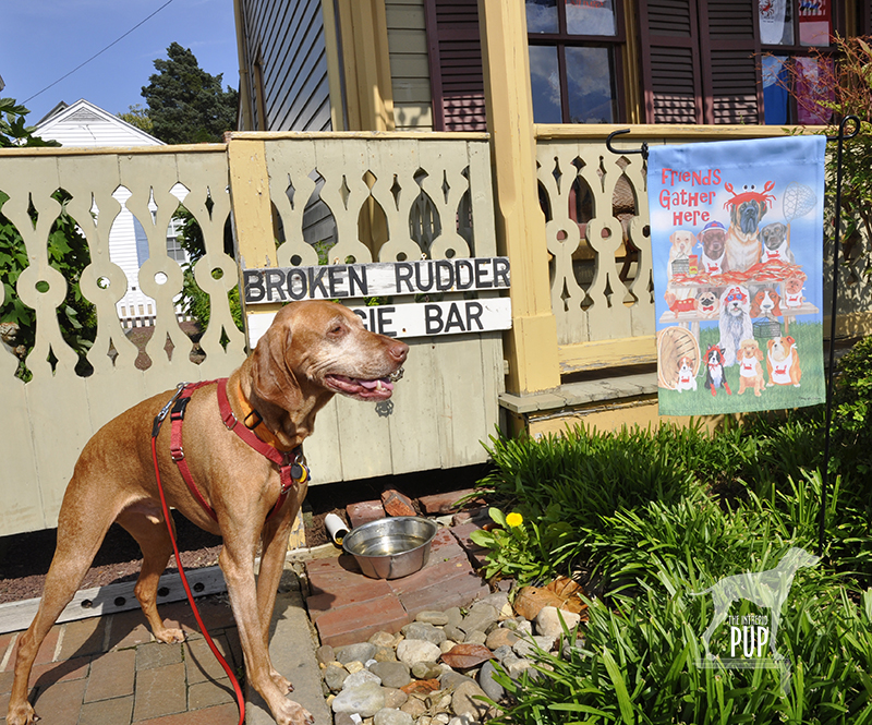
Talbot Street in St. Michaels caters to dogs with this complimentary, walk-up watering hole: the Broken Rudder Doggie Bar.

You’ll want to walk off your lunch, and St. Michaels’ Talbot Street/Route 33 is lined with plenty of shops, including a pet boutique named Flying Fred’s. If you pause to read historical plaques along the way—or fancy ducking into the St. Michaels Museum at St. Mary’s Square—you’ll learn that St. Michaels was where young Frederick Douglass lived as a slave from 1833-36. You’re also bound to hear how the resourceful residents of St. Michaels “fooled the British” during the War of 1812. With the British fleet approaching in August 1813, townsfolk hung lanterns high in the trees at the outer boundary. The British fell for the ruse and aimed their cannons such that most overshot the village, ultimately sparing it from a worse fate. We encountered many dogs along our walk, and several local businesses had treats for dogs and bowls of fresh water outside.

At this point, you might have worked up a thirst of you own, so a stop at Eastern Shore Brewing is in order. This local microbrewery opened in 2008 and operates out of a historic mill complex right on South Talbot Street.  They have a couple of year-round offerings and a half dozen seasonals on rotation. We tentatively poked our heads into the entrance just to survey the scene, assuming we’d have to come back another time minus our dog. No sooner had we done so, however, than one of the brewery staff spotted Tavish and hurried over to greet us.  “No, stay!” he said. “If your dog’s friendly, we’re dog-friendly. Heck, most dogs are better behaved than some of our patrons, so come on in!” And with that, we were swept inside to where a live band was playing and there was already a healthy crowd gathered for mid-Saturday afternoon. The bartender immediately brought over a bowl of water for Tavish, who promptly settled himself into a care-worn overstuffed leather chair (and got his photo taken by a few smartphone-wielding guests), while we tried a couple pints.

From there, we crossed Talbot Street and headed down West Chew Avenue to San Domingo Park, scenic green space that overlooks San Domingo Creek. If you bear to the right, you’ll see a trailhead and a covered bridge. The short paved trail runs more or less parallel to Talbot Street but through residential neighborhoods. A fifteen-minute walk will deliver you to Railroad Street, and you can hang a right to re-connect with North Talbot Street again.

On our next visit, we’ll definitely take the narrated, 70-minute sightseeing cruise aboard the two-level, 149-seat Patriot. We simply ran out of time that afternoon to fit this in, but in talking to the Captain dockside, we learned that the cruise is pet-friendly at his sole discretion. We’ll be back! Also nice to know is that even though ours was just a day trip, St. Michaels boasts several pet-friendly lodging options, from motor lodges to inns to vacation rentals.

Summer Fun: 5 Dog-Friendly OBX Destinations

Tavish on the beach by Jennette's Pier

OBX:  three little letters stand for North Carolina’s Outer Banks and a summer full of fun for dogs and people alike. Many locations along the Outer Banks are denoted simply by their milepost number along U.S. Highway 158.  At Whalebone Junction, the road becomes a decidedly less-congested N.C. Route 12 and is the gateway to Cape Hatteras, designated the country’s first national seashore in 1953. Beaches are dog-friendly, with regulations varying by town and season. Here are the Intrepid Pup’s picks for the top five scenic and sandy spots at this east coast playground:

Bodie Island Light Station

After wandering the grounds, be sure to follow the 1/8-mile boardwalk through the marsh for a picture-perfect view.

35° 49′ 5.30″ N,  75° 33′ 51.53″ W
Bodie Island Light Station
, Bodie Island, Cape Hatteras National Seashore, North Carolina
Open March – December

Throughout the centuries, the storms and shoals defining this stretch of coastline have wrecked more than 600 ships. Were it not for the area’s lighthouses and lifesaving services, this Graveyard of the Atlantic would have claimed even more. Don’t miss Bodie Island Light Station, the 164.4-foot black and white striped beacon whose light is visible from 19 miles at sea. Constructed in 1872, it’s actually the third light station to occupy that approximate location. Since 2000, it’s been maintained by the National Park Service, and you can even take a ranger-led tour up the tower.  While dogs aren’t currently allowed inside the light station, that wasn’t always the case. A Chesapeake Bay Retriever named Chess used to climb the tower every day, accompanying his master Vernon Gaskill who served as Bodie Island’s last civilian-era keeper (1919-1939).  According to Elinor De Wire’s book, The Lightkeepers’ Menagerie—on sale in the light station’s gift shopChess had no problem with the heights but apparently drew the line at entering the lantern room, because he didn’t like the odor of kerosene!

Tavish at the Lost Colony

The emptiness here adds to the mystery and kind of proves a point. After all, it is the Lost Colony.

35° 56′ 9.79″ N,  75° 42′ 35.35″ W
Fort Raleigh National Historic Site, Roanoke Island, North Carolina
Open year-round

A newly renovated visitor center at this National Park Service site interprets the history of Roanoke Island, from Algonquian homeland in the 1500s to a refuge for runaway slaves during the Civil War. But the spot is perhaps best known for what it wasn’t, namely a successful English colony. In fact, no one knows for certain what became of the English settlers who’d arrived in 1587.  When Governor John White returned to check on his transplants to the New World three years later, the 117 colonists plus White’s ill-fated granddaughter Virginia Dare (the first baby born to English settlers in Virginia) seemed to have vanished into thin air.  An abandoned fort and the word “CROATOAN” carved into a post are the scant clues in this unsolved mystery.

You, too, can explore the grounds of the lost colony. Pass a reconstructed version of the original earthen fort and join up with the Hariot Nature Trail for what amounts to about a 20-minute walk. We came upon a flock of ibises unhurriedly picking their way through the clearing. The wooded trail is slightly overgrown in spots and is punctuated by markers identifying types of trees and habitats. Sprinkled in are quotes drawn from accounts in Old English affirming the myriad challenges that the colonists faced. The trail provides a  picturesque view of Albemarle Sound before circling back to the Visitor Center.  Let us know if you happen to make the separate 2.5-mile round-trip hike on the Freedom Trail out to Croatan Sound—we were unfortunately thwarted in our attempt by a severe thunderstorm!

NagsHeadBeach

The Intrepid Pup officially “off duty” on the beaches of Nags Head.

35° 54′ 36.32″ N,  75° 35′ 43.77″ W
Nags Head Beaches & Jennette’s Pier, Nags Head, North Carolina (milepost 16.5)

Cape Hatteras National Seashore and the towns of Duck, Kill Devil Hills, Kitty Hawk, Nags Head, and Southern Shores all permit dogs on their beaches with varying degrees of seasonal access and leash laws. Team Tavish and the Intrepid Pup particularly like the beaches in Nags Head, because dogs are allowed on the beach year-round and at any time of day so long as they are on a maximum 10-ft leash and owners clean up.

Jennette's Pier

A bronze sea turtle stands watch by the pier house on Jeannette’s Pier.

While Tavish loves the water, he isn’t big on swimming, and that’s actually just fine here, because one does have to be mindful of the dangerous rip currents that can lurk offshore. But the beaches are clean and wide…perfect for an Intrepid Pup to snuffle the sand, poke at shells, crabs and seaweed, and skitter through the foamy surf. Walk the beach at sunrise and you’re sure to catch glimpses of skimming pelicans and playful porpoises offshore. Hard to miss at the heart of the beach’s Whalebone District is Jennette’s Pier (see photo at top). It’s been at this location since 1939, and  its current iteration is all concrete and extends 1,000 feet  into the Atlantic Ocean. Dogs aren’t permitted in or beyond the pier house, but you can get as far as the oversize bronze sculpture of a sea turtle. From that vantage point you can watch all the anglers heading out onto the pier to catch bluefish, cobia, skate, pigfish, mackerel, sea mullet, and more.

Tavish at Jockey's Ridge

The dunes at this state park are very cool…just be mindful of your dog’s paws, because the sand can get hot, hot, HOT!

35° 57′ 50.37″ N,  75° 37′ 59.38″ W
Jockey’s Ridge State Park
, Nags Head, North Carolina (milepost 12)
Open year-round

Did you know that this 420-acre state park represents the eastern United States’ largest natural dune system? It’s open to the public year-round, though park hours vary by season. Parking and general access are free. Dogs are allowed, so long as they remain on 6-foot leashes. From the visitor center, you can stroll a 360-foot boardwalk to a dune overlook, set out on the 1.5-mile “Tracks in the Sand” interpretive trail, take a mile-long walk on the “Soundside” nature trail…or simply scale the dunes. The shifting sands create a ridge that varies in height from 80 to 100 feet, providing spectacular views of the Atlantic Ocean and Roanoke Sound. With fairly steady prevailing winds, Jockey’s Ridge is a favorite destination for kiteboarders and sandboarders. On the morning of our visit, hang gliding lessons were just getting underway, and the park was also gearing up for a big kite festival. We’d been forewarned that the sand at Jockey’s Ridge can get anywhere from 10 to 30 degrees hotter than the air temperature, so Tavish came prepared wearing his Ruffwear Swamp Cooler™ vest (a real godsend that made all the difference in his comfort in the dry heat), and he had his protective paw booties at the ready.  A word to the wise:  try taking off your shoes. If it’s too hot to walk on the dunes barefoot, it’ll definitely be too hot for your pup!  When we reached the ridge, the radio announcer for the kite festival approached us to pet  Tavish. Taking stock of all of our water bottles and gear, he remarked, “Wow, I can’t tell you how many people I see come up here with no water for themselves, let alone for their dogs. Big mistake.”

Tavish Wright Brothers National Memorial

The sky’s the limit at the Wright Brothers National Memorial!

36° 0′ 51.20″ N,  75° 40′ 4.40″ W
Wright Brothers National Memorial, Kill Devil Hills, North Carolina (milepost 7.5)
Open year-round

Modern aviation is indebted to two Ohio brothers who journeyed to what at the turn-of-the 20th century was a remote patch of dunes. Carefully chosen for the winds, lack of distractions, and sandy landings, Kill Devil Hills was where Orville and Wilbur Wright first achieved powered, controlled, and sustained human flight on December 17, 1903.  You can follow in the brothers’ flight path with a visit to this National Park Service memorial. With Tavish in tow, we covered a total of approximately 1.5 miles walking the grounds. A pathway with stone markers traces the trajectories and landings of the Wrights’ first four powered flights. Trek uphill to get a panorama of the site, topped by a 60-foot granite memorial; it’s the same promontory from which the Wrights had earlier experimented with glider flights. Before turning back to further explore the informative Visitor Center, head downhill beyond the memorial. At the apex of the trail loop is a bronze and stainless steel sculpture group entitled, December 17, 1903. It captures the same instant of first flight as the iconic photograph and makes for a pretty nifty photo opp all its own!

Dogging the Details

Click to see what 2 on the Wag-A-Meter meansYou see a lot of dogs on the Outer Banks enjoying outdoor activities a-plenty. So at first we were puzzled by the fact that dog-friendly lodging and dining weren’t as abundant. It turns out that many dog-owning OBX vacationers rent beach houses by the week (Sunday to Saturday) so they’re not needing as many hotels and always have the option of cooking in.  That being said, there are approximately a dozen pet-friendly overnight accommodations. We stayed at the Dolphin Oceanfront Motel (milepost 16.5), finding it to be minimalist but functional, with its key attribute being that it had a primo location right on the beach. By no means inexpensive, it was still comparatively less pricey than the pet-friendly rooms at the national hotel chains and some of the local B&Bs.

Tavish at the Front Porch Cafe

Chillaxing at the Front Porch Cafe

Foodwise, we stopped at a couple places with patio dining only to discover that dogs weren’t allowed.  We hit the jackpot, though, in finding the Front Porch Cafe for breakfast. We ate at their locations in Nags Head (milepost 10.5) and Kill Devil Hills (milepost 6). In addition to making a good cup o’ joe, they have a wide assortment of muffins, pastries, and breakfast sandwiches. We sat outside in roomy Adirondack chairs, and the staff was quick to offer Tavish dog biscuits and a bowl of water.  Pigman’s Bar-B-Que was our other find. We took our order out to their picnic tables, and Tavish happily sampled our Carolina-style Que, hush puppies, fries, slaw, baked beans, and cornbread. OBX ranks a “2” on the Intrepid Pup’s wag-a-meter for providing enough canine fun in the sun, sand and surf to blow Tavish’s ears back! Grab a leash and go!

Gettysburg: Intrepid Pup Ventures to Hallowed Ground

Gettysburg_collage

Gettysburg’s hallowed ground. At left: the Virginia Memorial overlooks the field where Pickett’s Charge took place and General Lee lost more than 5,000 men in a single hour. Center: Cannon dot the fields along West Confederate Avenue, near the Observation Tower. At right: A memorial to the 5th Michigan Infantry in the Rose Woods.

Seven score and ten years ago, there was Gettysburg. Or, more to the point, the Battle of Gettysburg, the “High Water Mark” of the Civil War and its most devastating battle. The first three days of July 1863 turned Pennsylvania farmland into a blighted battlefield, claiming some 51,000 casualties and 3,000 horses. It’s a battle rightly memorialized—its tactics, weather, and personalities endlessly scrutinized.

Team Tavish’s visit to Gettysburg came about after spending the better part of a day hiking the trails at Maryland’s Catoctin Mountain Park (see blog post).  In consulting a map, Gettysburg looked to be close by, just across the Mason-Dixon line (and the Maryland-Pennsylvania border).  Before heading on, though, we consulted with a local just to be sure. Even as she confirmed that it’d indeed be a short trip, she began shaking her head. “You know, we used to take our horses out to ride the bridle trails at Gettysburg,” she said, her face clouding. “But those horses spooked every damn time. And if you were riding by yourself? Forget it. It’s like they knew.”

Gettysburg_20thMaine

Tavish traced the footsteps of fellow Mainers en route to Little Round Top and this memorial commemorating the role of the 20th Maine Volunteer Infantry Regiment.

So with that little sense of foreboding, we drove up the road to Gettysburg, covering in a half hour a distance we knew would’ve taken Civil War troops infinitely longer.

With a late afternoon arrival and a lot of hiking already under our belts, we opted to experience Gettysburg this time around via the 24-mile auto road.  A map obtained from the Visitor Center guided our way, and the sixteen stops provided ample opportunity to get out and explore. Cannon, historical markers, and memorials are at every vista. It seemed fitting for Tavish as a native Mainer to check out the memorial at Little Round Top dedicated to the 20th Maine Volunteer Infantry Regiment. As we traversed the path through the copse to the monument, the stillness was in marked contrast to the bedlam of July 1863. There, on the battle’s second day, Colonel Joshua Chamberlain and his Maine volunteers were charged with holding the beleaguered Union line at all costs. . . which ultimately translated to a bayonet attack and fighting at close range. The line held, and for his leadership that day, Chamberlain was awarded the Medal of Honor. Chamberlain would also go on to personally see the Civil War through to its conclusion at Appomattox Court House, Virginia, in 1865; General Grant asked Chamberlain to command the Union troops overseeing the surrender of weapons and colors by General Lee’s infantry. Notably, Chamberlain ordered his men to silently salute the Confederates as they passed. Chamberlain remains one of Maine’s most beloved native sons—for his battlefield valor as well as his post-war contributions as Maine governor and president of Bowdoin College. Chamberlain’s house remains open to the public and is interpreted as part of the Pejepscot Historical Society in Brunswick, Maine.

Gettysburg_wolfhound

Tavish meets the gaze of the wolfhound at the memorial to the Irish Brigade in the Rose Woods.

Our last task at Gettysburg was to locate the monument for the three New York regiments of the Irish Brigade.  The narrow approach skirts The Wheatfield—where fierce fighting killed and wounded more than 4,000 men—and then snakes into the Rose Woods.  Despite all the tourists at Gettysburg  on the afternoon of our visit, we were strangely alone when we came to Sickles Road. Dappled sunlight streamed through the trees, and it was here more than anywhere else that day that it wasn’t a stretch to imagine spooked horses. On the left of the roadside, a Celtic cross reaches some 19 feet skyward. Crouched in perpetuity at its base, head resting between outstretched paws, is a lone Irish wolfhound sculpted by William Rudolf O’Donovan, a veteran of Gettysburg.  The noble hound is meant to signify the fidelity of the Irish Americans who fought for the Union. The Irish Brigade had already suffered heavy losses in the war and on the evening of July 2, 1863, added another 76 to its grim tally of wounded, missing, and dead.

Gettysburg_IrishBrigade

The solemn stare of Gettysburg’s Irish wolfhound.

While the wolfhound on the Irish Brigade memorial is symbolic, many actual dogs have been documented in the annals of Civil War history. Some were adopted as unofficial regimental mascots,  others followed their masters to war, and still others were strays seeking human companionship in the encampments in the wake of the conflict.

Gettysburg demonstrates the power of place, and reminds us still—in the words of President Lincoln—”that from these honored dead we take increased devotion to that cause for which they gave the last full measure of devotion….”


Click to see what 2 on the Wag-A-Meter meansDogging the Details

39°48′40.08″N,  77°13′31.50″W
Gettysburg National Military Park, Gettysburg, Pennsylvania

Gettysburg earns a “2” on the Intrepid Pup wag-a-meter for the many ways in which one can experience the military park and its canine connections. Make like the Intrepid Pup, and embark upon your time at Gettysburg with a stop at the national park’s Visitor Center.  An outdoor sculpture of Abraham Lincoln (see below) provides a good photo op. Once oriented, you can set out by bike, via hiking trails, with a licensed battlefield guide, or on a self-guided auto tour.

Gettysburg_Lincoln

Penny for your thoughts? Tavish and President Lincoln sit for a spell at Gettysburg’s Visitor Center.

Leashed dogs are permitted on trails and grounds throughout Gettysburg National Military Park. Be sure to bring ample water for yourself and your dog; it can get pretty toasty on the battlefield, especially during the summer months. As always, be sure to clean up after your dog.

Pets are not allowed in the Visitor Center itself or at Soldiers’ National Cemetery where Lincoln delivered his now-famous Gettysburg Address on November 19, 1863—a little more than four months removed from the battle. To fully appreciate the extensive interpretive offerings at these two venues, you’ll need to return on your own.

One final note:  unlike Tavish—who unfortunately missed seeing this on his visit—you’ll want to be sure to seek out the monument to the 11th Pennsylvania Volunteer Infantry Regiment, located on Doubleday Avenue in the northwest corner of the park.  At its base lies a bronze replica of the regiment’s scrappy mascot, a bull terrier named Sallie. She was present at Gettysburg and had become separated from her regiment during the turmoil. Soldiers later located her at the day’s original battle line, where she was keeping vigil over the wounded and the dead. Sallie’s heroics were well documented throughout the Civil War. She had participated in the battles at Antietam, Fredericksburg, and Chancellorsville; purportedly received a tip of the hat from President Lincoln during a review of the troops earlier in 1863; and was subsequently wounded at Spotsylvania. Sallie died of a gunshot wound in 1865 during the Siege of Petersburg. Her comrades buried her on the battlefield.

National Howl-iday Scene: Part IV

montage of Christmas at Mount Vernon images

Tavish revels in “Christmas at Mount Vernon.” From the greenery adorning the entrance gates to the themed decorations within, George Washington’s estate is a festive place to be all the way through the holiday season. The Intrepid Pup posed in front of the one of several lavish Christmas trees and drooled (literally) at seeing the elaborate display of gingerbread houses. He even had a few friendly licks for Mount Vernon’s dog-loving plantation manager whom he met on the grounds!

If you’ve been a longtime follower of the Intrepid Pup, you might recall that Tavish originally introduced you to dog-friendly Mount Vernon in IntrepidPup.com’s first-ever blog post.  Now, Tavish returns to George Washington’s historic home on the banks of the Potomac River for Part IV in his round-up of the best of the DC metro area’s national “howl-iday” scene. (Visit the index to find the other spots that made the list)

“Christmas at Mount Vernon”  is celebrated annually at the estate from late November through the first week of January. To the authentic artifacts and educational experiences that already draw nearly 1 million visitors a year, Mount Vernon adds special activities for the holidays. You can watch costumed interpreters explore historical foodways by making chocolate, view a gingerbread display depicting a half dozen of Mount Vernon’s buildings, and find richly decorated Christmas trees throughout the orientation center and museum.  The rarely-seen third floor of the main house is open to visitors, and there are designated evenings prior to Christmas for candlelight tours.

Click to see what 2 on the Wag-A-Meter meansDogging the Details

38°42′29.65″ N,  77°05′07.67″ W
Christmas at Mount Vernon, George Washington’s Mount Vernon Estate & Gardens, Alexandria, Virginia

Christmas at Mount Vernon runs from late November through early January; check website for exact dates each year.

Tavish with Aladdin the Christmas Camel at Mount Vernon

“So, how long are you here?” Tavish shares a moment with Aladdin, the five-year old camel who puts in a guest appearance each year especially for “Christmas at Mount Vernon.”


As we’ve noted earlier, Mount Vernon does permit leashed dogs. While dogs do need to enter and exit via two public buildings, they’re otherwise instructed not to linger inside and understandably are not allowed at all in any of the historical structures.

There’s plenty to do on the 500-acre grounds—even in wintertime—and there are two things in particular to seek out that can only be seen during the six weeks encompassing “Christmas at Mount Vernon.”

The first is the camel. Yes, you read that correctly. George and Martha Washington used to welcome hundreds of people to their estate each year and were purportedly the consummate hosts. Records show that at Christmastime in 1787, Washington paid 18 shillings for the thrill of having a  “Christmas camel” come to Mount Vernon to entertain his holiday guests. This tradition has been kept alive in the present day through Aladdin, a real live camel. Aladdin’s regular home is on a Virginia farm with other exotics, but for six much-anticipated weeks a year he’s the celebrated guest at Mount Vernon. On the morning of our visit, Aladdin was contentedly sitting in his outdoor enclosure. Mount Vernon’s plantation manager was also on hand giving a short spiel. Then a large and very excited group of Cub Scouts arrived and peppered him with questions. What we gathered from this fairly humorous exchange is that Aladdin is five years old—very young in camel years—and quite tame. No, he isn’t the same camel that Washington met(!), nor is he a descendant from that camel. Camels are used to cold nights in their natural desert habitat, so Aladdin is not bothered in the least by December temperatures in Virginia. He doesn’t spit, since apparently that’s a learned behavior. Oh, and his best friend is a zebra. The plantation manager caught sight of Tavish and noted that Aladdin is comfortable around dogs, so he invited the two to make an acquaintance. Tavish was clearly intrigued, and he and Aladdin peered curiously at one another through the fence.

Tavish with Cobbler and Gobbler

Tavish maintains a respectful distance from the presidentially-pardoned turkey, Cobbler and his buddy Gobbler.

The other highlight to find is the turkey. Mind you, this isn’t just any turkey. This year it was Cobbler, who was officially pardoned by President Barack Obama as the National Thanksgiving Turkey in a White House ceremony on November 21, 2012. As part of the deal, Cobbler and his pal Gobbler greet the public throughout “Christmas at Mount Vernon” and then live out their retirement with other heritage breed animals as residents at Mount Vernon’s nationally recognized livestock facility. Tavish wasn’t nearly as keen on checking out the turkeys as he was the camel. Maybe it had something to do with Cobbler and Gobbler being pretty vocal and fanning their plumage, but Tavish elected to give them a very wide berth.

“Christmas at Mount Vernon” earns a “2” on the Intrepid Pup wag-a-meter, because just mentioning a dog, a camel, and a White House turkey in one breath sounds like some comedian’s opening line, right? Seriously, though, how many places can you witness such an unusual and historical combination for the holidays?

Out & About in Vacationland: Part II

Earlier this year Team Tavish wrote about the first Great Maine Outdoor Weekend (GMOW), a new bi-annual event that promotes physical activity and encourages folks to revel in all that’s great about Maine’s natural resources. September 28-30, 2012, marked the second GMOW, and with it, Tavish the Intrepid Pup promised to offer “Part II,” revealing three more stunning destinations in Vacationland. He enjoyed frequenting these places in the 5½ years he lived there, so he’s pretty confident that you and your dog will enjoy them too. So, without further ado…

Dogging the Details

wag-a-meter set at 2

Though in three separate regions of Maine, the excursions described below all rank “2” on the Wag-a-meter as being active, outdoor adventures requiring a little bit of planning. As always, be sure to bring along water for your dog, a snack, and some doggie bags.


MAINE LAKES AND MOUNTAINS

44°56′08.58″ N, 70°32′13.24″ W
Rangeley Lakes, Maine

Montage of Rangeley Lakes

Rangeley. The region is virtually synonymous with northern New England, and place names like Mooselookmeguntic and Height of Land simply reinforce its remote and wild allure. It’s the backdrop for Maine’s logging history. The playground for countless generations of sportsmen. The muse of the legendary Carrie Stevens (1882-1970) and her streamer fly. The setting for author Louise Dickinson Rich’s (1903-1991) best sellers, and the thirty-year summer retreat of iconic photographer William Wegman and his famous dogs.

To enter Rangeley is to embrace Maine’s great outdoors. Team Tavish and the Intrepid Pup  have twice stayed at Town & Lake Motel and Cottages; once in late May and again in October. Located on the shore of Rangeley Lake, next to where the sea planes dock, the motel is pet-friendly and a more than adequate home base from which to explore the area. In-room reading is a binder chock full of historical ice out dates, leaving no mistake that this is definitely a place for hard core snowmobilers and ice fishermen.

While Rangeley rightly promotes itself as a four-season wonderland, summer and fall are really the best times for visiting with your dog. Come prepared for great hiking, amazing scenery…and the near certainty of seeing moose.  But be equally prepared for black flies, cool nights, and rapidly changeable weather. Tavish made good use of his Ruffwear™ pack to carry extra food and water for the day. Wearing blaze orange was a must during our autumn hikes as hunting season was in full effect. (Click here to see some of his gear).

The Rangeley Lakes National Scenic Byway is a 35-mile ribbon incorporating sections of Routes 16 and 17. It’s also the access corridor to a number of trail heads of varying lengths and degrees of difficulty.  Tavish-approved highlights include:

  • The short 0.5 mile trail at the 2000-foot Cascade Stream Gorge, with views of 16-foot waterfalls and deep pools.
  • The roadside turnoff at Smalls Falls, with a walkway to see the 54-foot falls.
  • A 1.75 mile trail to the summit of Bald Mountain (2443 feet), with its 30-foot lookout tower.
  • The Appalachian Trail, with a 1.4 mile section to the impressive Piazza Rock.
  • Miles of trails on the 4120-foot Saddleback Mountain. This ski resort permits hikers on base area trails and ski runs during the off season. The chair lifts aren’t operational in the summer, but parts of the main lodge remain open. With wide open spaces, lots of birds to watch, and plenty of evidence of deer and moose, this was probably Tavish’s favorite to explore.


GREATER PORTLAND AND CASCO BAY

43°49′14.47″ N, 70°04′54.05″ W
Wolfe’s Neck Woods State Park, Freeport, Maine

Montage of Wolfe's Neck

Even if you’re otherwise unfamiliar with Maine, you’ve likely heard of Freeport, thanks to it being the venerated home of  outdoor outfitter L.L. Bean. The  flagship store is so touted as a Maine destination that you pretty much have to stop by. While you’re there, sneak a peek at the store’s doors. They’re notable for what’s missing, namely locks.  Since the facility is open 24 hours a day/365 days a year, there’s simply no need for them. That’s what we call a good dose of Yankee practicality. Seriously, check it out…and be sure to snap a photo out front with the 16-foot replica of the hunting boot that launched the company and secured Leon Leonwood Bean’s legacy in the annals of retail history. While your dog can’t accompany you in the store, there’s plenty of dog gear (hunting and otherwise) to be found inside. And you and your dog can always chill in Discovery Park; in the middle of the L.L. Bean retail campus, this compact greenspace doubles as an expo area during Bean’s product demo days and also has a stage on which the company presents its free summer concert series.

But if you can extricate yourself from the constellation of outlet stores downtown, you’ll find that Freeport “beyond the Boot” has a lot to offer in the way of natural splendor. Just a 5-minute drive and you’re quickly away from the 3 million visitors who flock to town each year. Take Bow Street to Flying Point Road, and make Wolfe’s Neck Woods State Park your destination.  L.L. Bean’s Paddling Center is just an inlet away from this easily accessible state park.

While you won’t likely get short of breath walking at Wolfe’s Neck, the views will most certainly take your breath away. Within steps of leaving the parking lot picnic area, the Casco Bay Trail slopes gently to where emerald conifer forest meets azure sea and sky. The stolid outcrops that dot the bay are whimsically called the “Calendar Islands,” because surely there are 365…one for every day of the year! The closest is Googins Island, an osprey sanctuary, and every time we’ve visited during the summer we’ve seen nesting osprey. The trail skirts a pebbly coastline before linking up to the Harraseckett and Hemlock Ridge trails to form about a mile-long loop returning you to the parking lot. Do note that there are no receptacles along the trail, so bag any waste for disposal back at the picnic area.

MAINE BEACHES

43°14′42.43″ N,  70°35′31.14″ W
Marginal Way
, Ogunquit, Maine

43°13′24.49″N,  70°41′30.11″W
Mount Agamenticus,York, Maine

Montage of Ogunquit

Not far after crossing Maine’s southernmost border you reach Ogunquit, a town whose apt Chamber-of-Commerce-tagline is “Beautiful Place by the Sea.” Park anywhere you can. Be forewarned that this is a particularly challenging task during the summer months, though a good place to try first is the pay lot just down Shore Road on Cottage Street. If you’re successful in finding a spot in the upper part of town (near the intersection of Route 1 and Shore Road), walk along Shore Road until you come to the Sparhawk Oceanfront Resort; a narrow walkway bordered by tennis courts and lush gardens leads to one of the best coastal trails you’ll ever come across: the Marginal Way.

Dogs are not allowed on the Marginal Way between April 1 and September 30 but are welcome on-leash from October 1 through March 31 (and you can take in the October “HarvestFest” and the December “Christmas by the Sea” activities then, too). The Marginal Way traverses Anchorage by the Sea Resort’s sprawling oceanfront before gaining elevation and hugging the rocky coastline for approximately 1 mile. The 39 benches dotting the paved path offer ample opportunity for quiet contemplation and gazing upon the oft-painted vistas of Ogunquit Beach, the Atlantic Ocean, and a small lighthouse. Marginal Way’s terminus is at Oarweed Cove; a narrow spit of land separates it from the compact yet equally picturesque Perkins Cove. Fishing charters depart from the wharf, and visitors flock to photograph the harbor, browse the cluster of art galleries and boutiques, and enjoy lobster rolls and chowder. While you can always retrace your steps—Marginal Way never gets old!—an alternate way back is to walk along Perkins Cove Road and then Shore Road, passing numerous shops en route.

A nearby point of interest is Mount Agamenticus, just 6.5 miles southwest of downtown Ogunquit, in York.  Take Route 1 south a few miles, make a right onto Agamenticus Road, and another right onto Mountain Way. Just when you start to think you’re lost on this curvy back road, you’ll see signs for the Mount Agamenticus summit. Rising only about 700 feet, Agamenticus is clearly no Everest, but its proximity to sea level makes it a prominent fixture on the horizon. The surrounding 10,000 acres are managed as a conservation region, thus preserving vernal pools, a superb vantage point for watching migratory hawks, a unique coastal ecological habitat, and a good bit of history. The first radar tower in the nation was placed atop Agamenticus in the 1940s, and the expansive view of the southern Maine coast made it strategic for spotting submarines and warships during WWII. In later years, wildfires became a greater threat than enemy vessels; the radar tower was supplanted by a fire tower still actively manned today. Agamenticus even enjoyed a brief and more benign stint (1964-73) as a ski resort. The summit lodge remains, and many of today’s multi-use trails (hiking, mountain biking, snowshoeing/cross-country skiing) were once ski runs.

Intrepid Pup loves the ruggedness, summit view, and relative solitude. Like giant calluses on the landscape, the smooth outcroppings of bedrock  on so many of the former ski slopes can prove slick for the two-footed (particularly during spring run-off and mud season), but scrambling over the terrain is what Tavish most enjoys about  a visit to Agamenticus. Choose from among three loop trails that vary in length from 2 to 3.2 miles.  Dogs must remain leashed, and all waste must be packed out, because there are no trash bins onsite.