Thanks for the adventure, Tavish

Vizsla on wooded trail

Friends, the moment we knew would inevitably arrive has happened. Friday evening with our beloved vizsla Tavish was our last.

What many of you may not have known was that in March, Tavish received a serious diagnosis. In putting him first—and considering with our veterinary team his quality of life and all possible options and outcomes—we concluded that his medical issues were unfortunately beyond the power to fix.

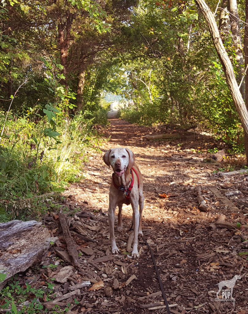
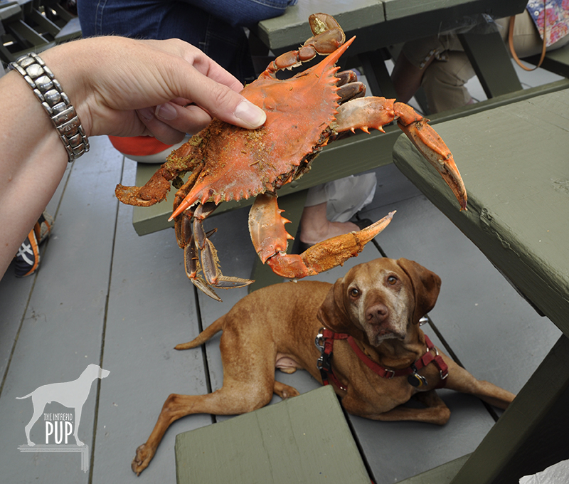
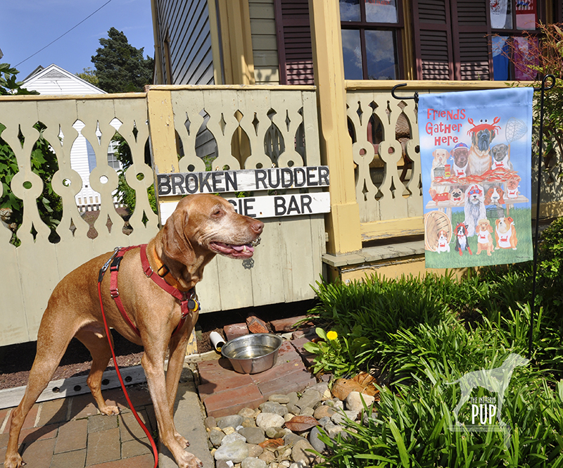
So, we concentrated on sustaining Tavish’s best life. The commitment to take each day as it came and to make the most of each one, made all the difference in how Tavish (and we) approached the past nine months, surpassing all prognoses. Together we created many more happy memories, logging countless additional miles on hikes and visiting eight more National Park sites—his enthusiasm transmitted up the leash.

This week his body ultimately betrayed him, but his sweet personality never wavered…not once. It was a final blessing that his end came swiftly and peacefully—within a matter of hours—and that we were at his side for mutual comfort.

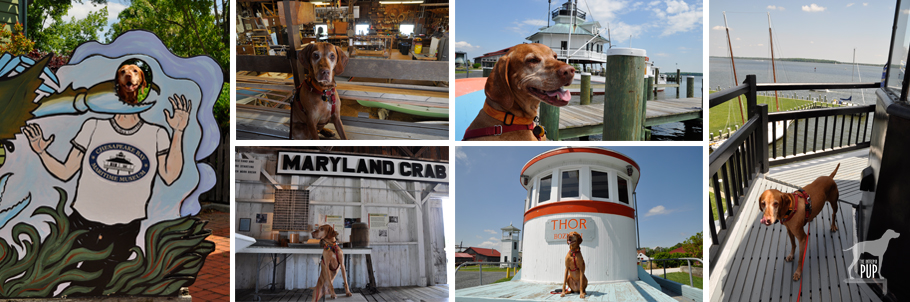
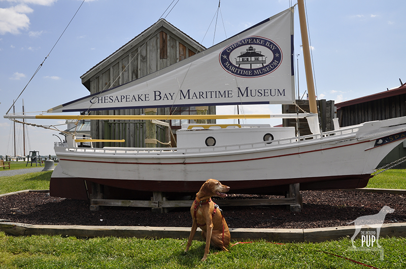
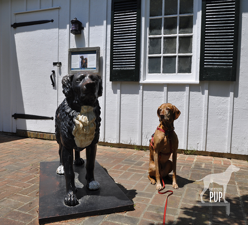
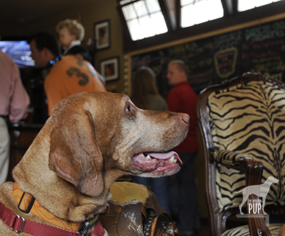
Tavish was a 14½-year gift who changed our lives in ways we never could have predicted. He effortlessly collected friends and unique experiences, and we’re grateful to have shared in them. Tavish visited more than 500 historical attractions, natural wonders, and cultural events in 19 U.S. states, the nation’s capital, and in Canada. He touched 400+ lives as an AKC-certified therapy dog making over 230 visits, mostly with children and the elderly. He’s won awards and been featured on Hungarian television, in a Voice of America broadcast, in a book about dog travel, in the Washington Post, and in Northern Virginia Magazine.

Everywhere we look there’s evidence of his impact and influence on our family. And that makes his loss (and our grief) all the more profound. But it’s also a powerful legacy. For those of you who have followed our Intrepid Pup via our website and social media, we’ll see what happens…. In the meantime, draw your loved ones closer. And if Tavish’s path has intersected with yours, please share memories with us as we try to find solace that he is now smiling on a trail free of discomfort, sorrow, and partings.

The coming days will be hard. Already we have opened the car door expecting our co-pilot to bound out. Pulled into the driveway, listening for a welcoming bark. Thought of a place we wanted to take him. Sat down on the couch and automatically left a spot for our friend to join. Reached out for the confidante who isn’t there. And, in the too-quiet, anticipated the clicking of Tavish’s nails on the floor signaling the Intrepid Pup’s trademark entreaty, “Come! Adventures await.”

Farewell, pup. Thank you for everything.

(June 6, 2005 – December 20, 2019)

A Day at the Bay

St. Michael's collage

Glimpses from around the 18-acre campus of the Chesapeake Bay Maritime Museum in St. Michaels, Maryland. Clockwise from left: a) Goofing around with the cut-outs in front of the museum; b) In the boat building workshop; c) Surveying the shoreline with the Hooper Strait screwpile lighthouse in the background; d) A tasty view of the harbor from atop the 1879 lighthouse; e) Catching some rays on the pilothouse of the buy boat Thor; f) Exploring the history of Maryland’s crab fishing industry.

It was a beautiful spring day, and we decided to head to Maryland’s eastern shore to do some exploring in St. Michaels, a town known for its Chesapeake Bay breezes, traditional Maryland fare (think:  blue crab and Smith Island cake, which are the official state crustacean and state dessert, respectively), and history (more about that later). To reach St. Michaels, you head for Annapolis which is a pretty snazzy dog-friendly stop in its own right, go over the Bay Bridge, and about 50 miles later (less than an hour, if the traffic gods are smiling upon you) wind up at your destination.

We didn’t set out with a real plan this time other than to savor the sights, the day, and okay…maybe some crab cakes. We followed Route 33/Talbot Street about a half mile into St. Michaels’ downtown and turned right to park in the Chesapeake Bay Maritime Museum’s lot.

Tavish at the Chesapeake Bay Maritime Museum

What!? Chesapeake Bay Maritime Museum is dog-friendly. How cool is THAT?!

We of Team Tavish were trying to figure out where along the fence line was the best spot to photograph Intrepid Pup Tavish with the museum’s signature lighthouse in the background, when…. whaaaaat?? Wait. A. Minute. Just on the other side of the fence we spied a Mutt Mitt Dispenser! You wouldn’t have one of those planted there if dogs weren’t welcome, right? So we stopped into the museum’s Admissions Building and inquired.  “Yes, of course!” the visitor services attendant replied. “You’ll need to keep your dog on a leash and clean up after him, but otherwise he’s allowed anywhere on the campus, except in buildings that have carpeting.” With that, we happily shelled out our entry fees (Tavish was free) and ended up spending nearly three hours there!

The museum was a real treat:  unexpectedly dog-friendly and far more extensive than we’d imagined. There were only four carpeted pavilions Tavish couldn’t go into. For those, we just took turns while one of us waited outside with Tavish, who did his share of rolling in the grass and watching the passing boats. Tavish even spied a beautiful tabby keeping an eye on us from a scrub pine. We later learned she’s a former stray who is now the museum’s resident salty boatyard cat, Ms. Edna Sprit! As for places Tavish COULD venture into, there were many! We wended our way through the Small Boat Shed housing the nation’s largest collection of Chesapeake Bay watercraft. We explored a dredgeboat to learn all about oystering and clambered out on the wharf to the working waterman’s shanty, where we got to check the eel pots and clumsily experiment with using oyster tongs.  And a real highlight was navigating a narrow spiral staircase and crawling through a hatch to reach the top of the 1879 Hooper Strait Lighthouse!

Tavish with Chesapeake Bay Retriever

An homage to Maryland’s state dog: Tavish sizes up this cast iron statue of a Chesapeake Bay Retriever outside the “Waterfowling” pavilion.

A bonus for dog lovers is the museum’s waterfowling exhibit chronicling a key element of bay heritage. While Tavish couldn’t partake of the fascinating display of hand carved duck decoys and tools of the trade, there was a stolid cast iron Chesapeake Bay Retriever statue outside with an interesting story (see photo at right).  It just so happens that in 1807, Marylander George Law was sailing home from England aboard the Canton, when he intercepted a sinking British vessel and rescued its crew and two Newfoundland puppies. When Law arrived safely at port, he purchased the puppies from the captain and brought them home. He named the male Sailor and the female Canton. Since Law ultimately had to go back out to sea, he gave the dogs to two men who allowed them to breed with local dogs, probably coonhounds. Their progeny had dense dual coats, took exceptionally well to the water, and were prolific in their versatility and ability to retrieve waterfowl. The Chesapeake Bay Retriever as a breed was born, and in 1964, it was recognized as Maryland’s official state dog.


Click to see what 2 on the Wag-A-Meter meansDogging the Details

 38°47’14.35″N,  76°13’13.73″W
Chesapeake Bay Maritime Museum
, St. Michaels, Maryland

St. Michaels ranks a “2” on the Intrepid Pup’s wag-a-meter for being exceptionally dog-friendly and offering plenty to do for pup and person alike.


Tavish at the Crab Claw Restaurant

Hmmm. . . lobster I’m familiar with from living in Maine. You? Not so much!

If you’re spending the day in St. Michaels, you’ll need to grab a bite to eat, and fortunately there’s a quintessential Maryland-y option that’s also dog-friendly: The Crab Claw Restaurant. This is definitely fair-weather casual dining, because with your pup in tow, you’ll be eating outside on the partially covered, spacious deck. Be prepared to wait a bit for your picnic table, since lots of people will have this very same idea on sunny weekends. It’s worth it, however, for the good food and spectacular view of the bay. Truth be told, the people-watching is equally entertaining, as folks pull up in boats of all shapes and sizes. After noticing a young couple a few tables away too full to finish off their dozen crabs, we decided to order the less messy and labor intensive option: crab cakes. Tavish was acting particularly winsome that afternoon, and it wasn’t long before the woman from the couple came over to pet and take pictures of Tavish.  And. . . somehow we ended up with the remainder of their steamed crabs! Tavish is a shameless charmer and seemed both intrigued and pretty smug about this turn of events (see photo at left). Unbelievable.

Tavish at the Broken Rudder Doggie Bar

Talbot Street in St. Michaels caters to dogs with this complimentary, walk-up watering hole: the Broken Rudder Doggie Bar.

You’ll want to walk off your lunch, and St. Michaels’ Talbot Street/Route 33 is lined with plenty of shops, including a pet boutique named Flying Fred’s. If you pause to read historical plaques along the way—or fancy ducking into the St. Michaels Museum at St. Mary’s Square—you’ll learn that St. Michaels was where young Frederick Douglass lived as a slave from 1833-36. You’re also bound to hear how the resourceful residents of St. Michaels “fooled the British” during the War of 1812. With the British fleet approaching in August 1813, townsfolk hung lanterns high in the trees at the outer boundary. The British fell for the ruse and aimed their cannons such that most overshot the village, ultimately sparing it from a worse fate. We encountered many dogs along our walk, and several local businesses had treats for dogs and bowls of fresh water outside.

At this point, you might have worked up a thirst of you own, so a stop at Eastern Shore Brewing is in order. This local microbrewery opened in 2008 and operates out of a historic mill complex right on South Talbot Street.  They have a couple of year-round offerings and a half dozen seasonals on rotation. We tentatively poked our heads into the entrance just to survey the scene, assuming we’d have to come back another time minus our dog. No sooner had we done so, however, than one of the brewery staff spotted Tavish and hurried over to greet us.  “No, stay!” he said. “If your dog’s friendly, we’re dog-friendly. Heck, most dogs are better behaved than some of our patrons, so come on in!” And with that, we were swept inside to where a live band was playing and there was already a healthy crowd gathered for mid-Saturday afternoon. The bartender immediately brought over a bowl of water for Tavish, who promptly settled himself into a care-worn overstuffed leather chair (and got his photo taken by a few smartphone-wielding guests), while we tried a couple pints.

From there, we crossed Talbot Street and headed down West Chew Avenue to San Domingo Park, scenic green space that overlooks San Domingo Creek. If you bear to the right, you’ll see a trailhead and a covered bridge. The short paved trail runs more or less parallel to Talbot Street but through residential neighborhoods. A fifteen-minute walk will deliver you to Railroad Street, and you can hang a right to re-connect with North Talbot Street again.

On our next visit, we’ll definitely take the narrated, 70-minute sightseeing cruise aboard the two-level, 149-seat Patriot. We simply ran out of time that afternoon to fit this in, but in talking to the Captain dockside, we learned that the cruise is pet-friendly at his sole discretion. We’ll be back! Also nice to know is that even though ours was just a day trip, St. Michaels boasts several pet-friendly lodging options, from motor lodges to inns to vacation rentals.

Oh Shenandoah, I Long to See You

Brown House at Rapidan Camp

In visiting Rapidan Camp, Herbert Hoover’s presidential retreat in Shenandoah, the Intrepid Pup follows in the footsteps of such luminaries as aviator Charles Lindbergh and inventor Thomas Edison. Here, Tavish lounges on the porch of Brown House, the Hoovers’ personal cabin, at the terminus of the 2-mile Mill Prong Trail.

Rapidan's Outdoor Hearth

Rapidan Camp’s outdoor fireplace provides a good backdrop for photos, just as it did in Hoover’s time.

From 1929 to 1932, President Herbert Hoover and First Lady Lou Henry Hoover relished their rustic fishing camp in Shenandoah. Fortunately, three of the 13 original buildings constituting their Rapidan Camp have been preserved, and you can enjoy it, too.

One option is to board a shuttle bus at the Byrd Visitor Center for a ride down a fire road as part of a three-hour, ranger-led tour. But you can’t bring your dog. And that hardly seems sporting when the second option is a moderate hike that’s dog-friendly. The trail to Rapidan winds through the very forests that so appealed to the Hoovers as a presidential retreat just 100 miles from the pressures and summer humidity of Washington, DC. The Hoovers built the camp with their own funds, the design largely influenced by the First Lady’s own experience in working with the Girl Scouts. Their personal cabin, known simply as The Brown House, had a comfortably open floor plan, welcoming hearth, and Navajo rugs. The president maintained a separate bedroom/office so he’d not disturb his sleeping wife when White House business kept him burning the midnight oil. Meals were eaten in a communal mess hall to promote camaraderie. Days were spent fishing, horseback riding, and entertaining a steady stream of official guests.

The Hoovers' Norwegian Elkhound Weejie

The Hoovers had several dogs, but it’s their Norwegian Elkhound named Weejie who most often appears in Rapidan Camp press photos like this one from 1932. This particular AP image is part of the onsite interpretive exhibit at Rapidan’s Prime Minister’s Cabin.

Hiking into Rapidan affords you the opportunity of getting the lay of the land. Outdoor signage marks where the other buildings used to stand, and the Prime Minister’s Cabin (so dubbed for Ramsay MacDonald’s visit in 1929) now contains a comprehensive exhibit about the Hoovers and how their presence shaped development in the region. In addition, a park volunteer is on hand most of the year to answer questions and provide hikers with impromptu tours of the Brown House. Our arrival was met by a very personable and knowledgeable history Ph.D. graduate student named Jonathan who was living onsite in the Creel House and serving as Rapidan’s resident caretaker for the summer. From him we learned that Hoover gifted Rapidan Camp to the government upon leaving office, and the camp was incorporated into Shenandoah National Park in 1935. The camp enjoyed use by the Boy Scouts up until 1959, when the Park Service removed all but the existing three structures. Rapidan continued to host senior U.S. officials into the early 1990s, although Maryland’s Camp David had long since supplanted Rapidan as the official presidential retreat.

The grounds and buildings underwent a full restoration in 2004 to return them to how they appeared during the Hoovers’ residence, and they remain a fascinating time capsule of a bygone era.

Dogging the Details

Click to see what 2 on the Wag-A-Meter means38°29′26.49″N, 78°25′10.93″W
Rapidan Camp, Shenandoah National Park, VA (trailhead at Milam Gap)

The Intrepid Pup wag-a-meter registers an emphatic “2” for this excursion. It requires a modicum of  pre-planning, but the pay-offs include a good workout and a unique historical destination.

With more than 500 miles of hiking trails and only 10 trails on which pets are not permitted, there’s a lot for you and your leashed dog to explore at Shenandoah National Park. If you’re coming by car, there’s a $15 entrance fee per non-commercial vehicle (slightly less if it’s December – February), and your pass is good for the day of entry and the next 6 days, so you’re definitely getting your money’s worth. Road and trail maps are available at any of the ranger stations, and you can download a map for the Rapidan Camp area here.

Mill Prong Trail

Tavish at one of three stream crossings en route to Rapidan Camp

Begin your journey by parking at the Milam Gap pull-off just shy of mile marker 53 along Skyline Drive. The Mill Prong Trail is the most direct route to Rapidan Camp, and the trailhead is just across the street from the parking area. The path is shady, well-groomed and well-marked with tree blazes and concrete posts at trail junctions. It’s two miles downhill on the way in. There are three water crossings, but unless the streams are running high, you can easily ford them by stepping from boulder to boulder. With the last water crossing at Big Rock Falls—a distinctive but gentle cataract flowing into a shallow pool—you’re on final approach to Rapidan Camp.

Nature-wise there were butterflies, huge millipedes, and a couple of chipmunks. Ultimately we encountered more gnats (note: insect repellent is helpful) than hikers and saw no other dogs…but we suspected that it gets more crowded on the weekends. Hiking in took an hour but included several photo stops. For the return trip, we hiked out the same way we came (for a 4-mile round trip total). But if you’re up for a longer circuit hike (7.4 miles total), the alternative is to pick up the Laurel Prong Trail at Rapidan Camp and follow it until it intersects with the Appalachian Trail, which turns northward over Hazeltop Mountain and ends back at the Milam Gap parking area.

Pet-friendly lodging:

Team Tavish enjoys camping, but for this particular trip we had sought a night’s stay in pet-friendly accommodations and were pleased to find a few choices. There are a limited number of in-park, pet-friendly rooms at Lewis Mountain Cabins, Skyland, and Big Meadows Lodge.  We opted for a traditional room at Big Meadows, as it was closest to the trailhead for Rapidan Camp. It was reasonably priced and offered adequate amenities: coffee maker,  double beds, and a small bathroom (no phones or TVs, but there is wi-fi and a TV room in the main building, if you’re so inclined). While dogs aren’t allowed inside the main lodge where the dining options are, you can get pub fare from the Taproom restaurant and eat on the terrace with its none-too-shabby view of the sunset over the Blue Ridge. We saw probably a half dozen dogs being walked on the grounds the next morning, so clearly we weren’t the only ones availing ourselves of the pet-friendly lodging.

Tavish sees a snake

From a safe distance, Tavish observes what was by all accounts Rapidan Camp’s resident non-venomous snake.  We’d read that snakes can strike at a distance up to half their body length. Had this been one of Shenandoah National Park’s pit vipers—identifiable in part by their more triangular-shaped heads—Intrepid Pup wouldn’t be posing for a photo.

Special considerations:

Mosquitoes and ticks are almost givens in any woodland excursion, but hiking in Shenandoah presents two additional cautions (yay!): snakes and bears. Poisonous copperheads and rattlesnakes do reside in the park. Read up on dog-versus-snake encounters, and you’ll be sufficiently freaked out. Dogs usually weigh less than people and thus are more readily “incapacitated” (to use a euphemism) by snake venom. That being said, the snakes in Shenandoah aren’t exactly out trolling for hikers and dogs and would much rather be left alone. In the end, Team Tavish concluded that basic avoidance was going to carry the day, and our modus operandi was hyper-vigilance about not letting Tavish stray from the main trail so he could literally let sleeping snakes lie.

Shenandoah National Park also has one of the densest populations of American black bears in the United States, and pretty much any piece of park literature you’re apt to find includes information about bear safety. They’re purportedly “skittish” and tend not to pose any threat so long as you give them a wide berth, keep food out of the equation, and don’t run away. Another oft-repeated piece of advice is to “let the bear know you’re human” (i.e. wave your arms, make noise, speak in normal tones, etc.), but our travel companion—a close family friend and fellow blogger—joked that in the event of a bear encounter she would also be readily enumerating her other human attributes like, “I can read, I have opposable thumbs, and I have relatives that care about me.” As it turns out, we were glad to have reviewed bear basics because while hiking the 4-mile Rose River Loop Trail the next day, some oncoming hikers alerted us that they had just seen a bear not 200 yards ahead. They said it had shuffled off into the woods when it heard them approaching and, indeed, we never saw it.  We did, however, catch a glimpse of a bear standing at the side of the road as we were driving out of the park.

Special gear:

While you can count on temperatures being cooler in the mountains, you still need to keep hydrated, so bring plenty of water for yourself and your dog. Team Tavish used a CamelBak for water and snacks, and Tavish carried his own water and gear in Ruffwear’s Palisades Pack™ (be on the lookout for an upcoming product review in the near future). Remember to keep your dog on a 6-foot leash as the park’s leash policy is enforced for the safety of dogs, visitors, and wildlife alike. Finally, beautiful scenery is at every turn, so don’t forget to pack a camera!

A Tail at Three Sites

Tavish at Best Farm, Monocacy National Battlefield

Tavish at Best Farm, Monocacy National Battlefield

Many are the lessons that can be learned from historical sites, and a visit to Maryland’s Monocacy National Battlefield a few weeks ago was no exception. For Tavish the Intrepid Pup, the teachable moment came from a “stimulating” encounter snuffling the grass around a low-voltage electric fence by the cow pasture at the Worthington Farm site. (Note: no worries, he’s fine…just a lot more observant now when it comes to fences.) For Team Tavish, it was the realization that were it not for what happened at Monocacy back on July 9, 1864, the Civil War might have taken a different turn.

The battle at Monocacy represented the third and final Confederate invasion of the North. It often doesn’t get its due in history books because of the more epic scale of the previous two invasions at Antietam (1862) and Gettysburg (1863). But Monocacy is intriguing in its own right. With great irony, it was the Union army loss of the battle that actually saved the nation’s capital a mere 47 miles away. There are far greater chroniclers of Civil War battle strategy than the Intrepid Pup, but the basic storyline of Monocacy is this:  Ulysses S. Grant was beginning to successfully deter Robert E. Lee’s Confederate forces in the east. To sustain the pressure on those forces, Lt. General Grant was diverting to Richmond fresh reinforcements in the form of seasoned troops from the various forts that protected Washington, D.C. With relatively few soldiers left behind to “mind the store” so to speak, Lee recognized an opportunity and tasked Lt. General Jubal Early (1816-1894) with making a relatively quick run north up the Blue Ridge to cross at Harper’s Ferry and then invade the capital from the northwest. Early and his men very nearly succeeded except for  intervention from an unlikely source: John Garrett. Personally, Garrett was a Confederate sympathizer. Professionally, however, Garrett was the president of the Baltimore and Ohio (B&O) Railroad with many of his clients and much of his business centered in Union territory. It was he who alerted Major General Lew Wallace, stationed in Baltimore, to Early’s troop movements. Wallace had precious little time to react and even fewer resources to muster, but with an inexperienced band of 2,800 short-term recruits (i.e. not battle trained), he set out to intercede Early. The good news for Wallace was that by the time he encountered Early’s Confederate forces at Monocacy on July 9, his Union ranks had swelled to 5,800. The bad news for Wallace was that he was still outnumbered three to one. Imagine going into battle with full knowledge that the odds are squarely not in your favor.

The battle played out over about 12 hours amid several farmers’ fields and along a rail bed and the banks of the Monocacy River…you can still “read” the battle in the landscape today. By almost any measure, Wallace had been defeated and had lost nearly a quarter of his men in the process. Yet Early hadn’t expected to meet such resistance at Monocacy, and the fighting cost him some 900 men and critical hours. With no choice but to encamp on the battlefield the night of July 9, Early had effectively lost a day—and the element of surprise—in an already tight timeline. Early’s men pushed onward the next morning and reached the northwest boundary of Washington by the following afternoon to mount an attack on Fort Stevens. The delay, however, had given Grant just enough time to send steamships full of soldiers to repopulate the defensive forts around Washington. So, while the fighting at Fort Stevens on July 11 was fierce and deadly, it was not enough to fully infiltrate the nation’s capital. Early withdrew, ultimately unsuccessful in his mission.

Tavish at Fort Stevens

Tavish at Fort Stevens. President Abraham Lincoln went to witness the fighting here on July 11, 1864. Confederate sharpshooters aimed for him, making Lincoln the only U.S. President to come under direct enemy fire in time of war.

Tavish at Battleground National Cemetery

Tavish at Battleground National Cemetery

Fifty nine Union soldiers lost their lives in the Battle of Fort Stevens—the only Civil War battle to be waged in the District of Columbia—and 41 were buried the evening of July 12 at a site a half mile north of the fort on the battleground itself. President Lincoln attended the interment ceremony and consecrated the land as hallowed ground. Now known as Battleground National Cemetery, this tiny plot of land on Georgia Avenue, N.W. between Van Buren Street and Whittier Place is among America’s smallest national cemeteries. Added over the years were various monuments commemorating the regiments that fought, as well as several plaques bearing such sentiments as: “The muffled drums’ sad roll has beat the soldier’s last tattoo. No more on life’s parade shall meet that brave and fallen few.” There’s also a stone superintendent’s house designed by General Montgomery Meigs (1816-1892), a veteran of the Battle of Fort Stevens and also the architect/engineer of DC’s Pension Building that today houses the National Building Museum.

And what ever happened to Major General Wallace (1827-1905)? Yes, he lost the battle but survived the war and, interestingly enough, went on to write the famous novel Ben-Hur: A Life of the Christ (1880). His book was subsequently adapted for the silver screen several times, with the most notable version being the 1959 film classic (starring Charlton Heston and his famous chariot race scene) that reaped 11 Academy Awards.

Dogging the Details

Click to see what 2 on the Wag-A-Meter means39°22′37.90″N, 77°23′43.34″W
Monocacy National Battlefield
, Frederick, Maryland

38°57′52.05″N, 77°1′44.67″W
Fort  Stevens, Washington, DC

38°58′14.69″N, 77° 1′37.23″W
Battleground National Cemetery, Washington, DC

Monocacy NB

Tavish among the bluebells on the Ford Loop Trail, Monocacy National Battlefield

Because of the three sites’ relatively close proximity to one another, tracing the full story of Monocacy—from the initial battle in Frederick, Maryland, to the conclusion at the tiny cemetery in Washington—is easy to experience in one very full day or over the course of two  leisurely days. There’s the most ground to cover at Monocacy National Battlefield. Begin your foray at the visitors’ center on Urbana Pike. It used to be in smaller quarters at the Gambrill Mill site but moved to this nice new building about five years ago. Although dogs aren’t allowed inside the visitor center, make sure you head upstairs. There’s a succinct yet exceptionally comprehensive exhibition with an overhead timeline, lighted battle map, and several interactives that really help put what you’re about to see outside in a broader context. Be sure to pick up a brochure from the ranger, because it contains not only driving directions but also a trail map. There are 5 separate locations within the national park to get out explore with your dog. As always, dogs are to be leashed and picked up after:

  • While Best Farm and Monocacy Junction don’t have any trailheads per se, there’s plenty of room to explore the immediate vicinities from the parking areas. Best Farm is also associated with a remarkable 1862 event related to Antietam (Learn more at the visitors’ center or Google “Lee’s Lost Orders”!).
  • During the battle, the Gambrill Mill site was co-opted as a Union field hospital, and the short loop trail here includes a boardwalk section leading to the Monocacy River. Tavish enjoyed wading in the shallows.
  • The Thomas Farm site contains two loop trails that wind through the farm fields that withstood the heaviest fighting that day in 1864.
  • Worthington Farm has the longest trails, though neither of the two loops takes more than a half hour to hike. We went on a Sunday afternoon and had the place mostly to ourselves save for a couple joggers. The Ford Loop Trail is flat and hugs the flood plain of the Monocacy River. Should you happen to time it right in the springtime, as we did by happy coincidence, you’ll find the path to be spectacularly carpeted with Virginia bluebells (see photo). Much of the Brooks Hill Loop Trail borders the aforementioned cow pasture. Fresh from his fence episode, Tavish curiously appraised the gangly calves and their moms from a respectful distance. Once the trail enters woodland it quickly gains elevation, topping out on a ridge with an expansive view across emerald farmland toward Thomas Farm.

Back in the District of Columbia, visiting Fort Stevens simply involves snagging a parking spot on the street or in the neighboring church parking lot. All that remains of the once extensive Civil War Defenses of Washington are more than 20 locations throughout DC-MD-VA ranging from simple forest sites to earthworks to full-fledged forts. Fort Stevens is not staffed but does have a couple interpretive panels to orient visitors to the partial reconstruction. Continue the short distance to conclude your journey by parallel parking on Georgia Avenue in front of Battleground National Cemetery.

Thanks, Teddy!

Tavish at Roosevelt Island If you’re as big a fan of America’s national parks as Tavish the Intrepid Pup, then National Park Week is like having Christmas, a birthday, and the 4th of July all rolled into one. In 2012 National Park Week runs from April 21 through April 29. Jointly promoted by the National Park Service (NPS) and the National Park Foundation—the parks’ official charity—National Park Week collectively celebrates the 84 million acres preserved as “America’s best idea” by offering free admission to all 397 national park sites throughout the country. To be fair, more than 250 of these are free year-round, but in going fee free system-wide for a week, cost simply can’t be an excuse for not visiting a national park. So, in the spirit of Intrepid Pup:  “Come! Adventures Await.”©

Throughout the week, Intrepid Pup will highlight various NPS sites he’s visited recently, so check back often! In the meantime, we’re starting with the Theodore Roosevelt Island National Memorial because, seriously, where better to step off National Park Week than the place dedicated to the guy who first made the environment and national parks central to domestic policy?

Theodore Roosevelt (1858-1919) became the the youngest man to ascend to the U.S. presidency, taking over when President McKinley’s term ended prematurely with an assassin’s bullet. While Roosevelt can’t lay claim to designating Yellowstone the country’s first national park (President Grant had that honor in 1872) or even to establishing the National Park Service (President Wilson got the credit in 1916), he arguably did more to shape the tenor of American resource conservation than any president before or since. During Roosevelt’s 1901-1909 tenure as the 26th president of the United States, he created five national parks and established the U.S. Forest Service. With the passage of the 1906 Antiquities Act he provided the precedent and legislative vehicle for presidents to protect historically significant sites as National Monuments…of which he then personally authorized 18. All told, among national forests, parks, game preserves, bird reservations and national monuments Roosevelt amassed a legacy of preserving a staggering 230 million acres of public land.

To visit Roosevelt Island today is to step onto a sylvan oasis. Wedged between Virginia and the District of Columbia’s banks of the Potomac River, this 88-acre dollop has had a schizophrenic past:  Inhabited by 16th-century Native Americans. Overtaken by various colonials in the 18th century. Owned by George Mason (author of the Virginia Declaration of Rights) and later by his son in the early 19th century for entertaining high society in a summer house built upon its ridge. Utilized by the 1st U.S. Colored Troops as a Civil War mustering ground in 1863. Cherished as a safe haven for escaped and freed slaves fleeing the South between May 1864 and June 1865.

The Roosevelt connection didn’t come until the 1930s, when the Theodore Roosevelt Association acquired the island and promptly transferred title to the National Park Service. Initial efforts to create the only capital-area memorial to Roosevelt involved the Civilian Conservation Corps removing invasive vegetation and planting nearly 20,000 native trees. Frederick Law Olmsted Jr. (1870-1957) was enlisted to come up with an overall design. Various issues hampered progress, including World War II, and the project wasn’t resumed until the 1960s. Though Olmsted had passed away in the intervening years, many of his original ideas like a Memorial Plaza and foot trails survived the final plan put forth by Eric Gugler (1889-1974). Paul Manship (1885-1966)—perhaps better remembered for his Prometheus Fountain in New York City’s Rockefeller Center—designed the 17-foot bronze statue of Roosevelt ultimately dedicated on the site in 1967.

In Tavish’s visits to the island, we invariably begin at the expansive Memorial Plaza where Roosevelt stands at the far end, backed by a 30-foot granite shaft, right arm raised above his head as if he were in the midst of an animated speech. Four 21-foot granite tablets bear Roosevelt quotations under the headings of Nature,  Manhood, Youth, and The State. Three trails (Swamp, Woods, and Upland) radiate from the plaza; none are longer than 1.3 miles. Except for a traffic helicopter’s shadow raking through the tree canopy or the dull roar of a Dc-9 following the river southward on its final approach to Ronald Reagan-Washington National Airport, you’d never believe you’re so close to the city. Don’t go expecting dazzling waterfront views; for most of the year, heavy foliage occludes shoreline panoramas of the Kennedy Center, the Watergate and Georgetown. The Potomac River is tidal but it’s fresh water that infiltrates the marshland skirting the Swamp Trail’s boardwalk. On our most recent jaunt yesterday, yellow irises were in bloom. Low tide had temporarily marooned minnows in the shallows. We spotted numerous marsh birds and encountered three deer grazing on green tendrils mere feet from the boardwalk. Two salamanders basking in the sun skittered away when we approached.

Roosevelt Island is one of five NPS sites—if you don’t count his visage on Mount Rushmore—specifically honoring our 26th President. (Intrepid Pup bonus points if you can name the others! Answers are below.*) In hiking the island,  Roosevelt’s foresight for preserving parkland is readily appreciated. As one of his quotations chiseled in the nearby stone states:

“The nation behaves well if it treats the natural resources as assets
which it must turn over to the next generation increased and not impaired in value.”

Thanks, Teddy!

Dogging the Details

38°53′50.70″N, 77°3′50.22″W
 Theodore Roosevelt Island National Memorial, Virginia

Click to see what a "1" on the Wag-a-meter means By car, one can only reach the parking lot for Roosevelt Island from the northbound lanes of the George Washington Memorial Parkway. The  lot serves as a trailhead for runners and cyclists on more far-flung journeys along the Mount Vernon and Potomac Heritage Trails. Though most who park here likely never cross the pedestrian bridge onto the island, the grounds nonetheless attract a fair share of walkers and joggers. Dogs are permitted on the island but must be on a 6-foot leash at all times. As always, pick up after your dog. Trash receptacles are understandably sparse along the island’s trails but are abundant in the parking area.

Be aware that low-lying areas of the island flood easily, and sections of trail are seasonally boggy or otherwise closed. Consult the bulletin board on the island side of the pedestrian bridge for current trail info.  Bear right and make the first left uphill to view the Memorial Plaza; otherwise stay right to embark on the Swamp Trail that encircles the island. The Island scores a “1” on the Intrepid Pup Wag-a-Meter for its easy hiking.

*The other four Roosevelt-related NPS sites are Roosevelt National Park (North Dakota), the Roosevelt Birthplace National Historic Site (New York City), Sagamore Hill National Historic Site (Oyster Bay, NY), and the Roosevelt Inaugural National Historic Site (Buffalo, NY).