

Faster than a flying Orville? Why, yes! Tavish covered the famous “first flight” distance of 120 feet in about half the time it took Orville Wright to fly it — without even breaking into a pant.
In this post we’re seeing if Intrepid Pup Tavish is faster than an airplane. Well, not just any airplane. More specifically: whether he’s faster than the first airplane. And to do that, we head to Kill Devil Hills, North Carolina, where brothers Orville and Wilbur Wright first achieved powered, controlled, and sustained human flight on December 17, 1903 at 10:35 AM.
The site was a relatively remote coastal area when the Wrights were here more than a century ago, and they’d specifically chosen it because they could experiment without a lot of distractions and—presumably—prying eyes. The dune environment also afforded fairly consistent breezes and sandy landings to boot. After all, laying claim to being the first in flight was very much a risky venture!
Today Kill Devil Hills is a big draw for beach-goers to the Outer Banks, and the Wrights’ humble proving ground is now managed by the National Park Service as the Wright Brothers National Memorial.
A short distance from the Visitor Center is a large granite boulder commemorating the spot where Orville took flight. A pathway extends from it, and four markers along the way show the ever-increasing distances the Wrights successfully flew that momentous morning. To better Orville’s historic first flight, Tavish would have to cover 120 feet in less than 12 seconds. Complicating matters was that 1) park regulations dictated that Tavish needed to remain on a leash, and 2) a preponderance of prickly pear cacti in the field meant he also had to stay on the straight and narrow! In fact, Tavish had already managed to step on a prickly pear earlier in his visit, so he wasn’t eager for a repeat.
With one member of Team Tavish holding the leash and the other standing at the 120-foot mark with the stopwatch app primed on a smartphone (my, how far technology has come!), Tavish was literally straining to get going. But could he do it? In a word? Yes. Handily. The Intrepid Pup didn’t exactly break the sound barrier that pilot Chuck Yeager would end up doing a mere 44 years after Orville severed the bonds of earth…but, boy, did Tavish hustle! Final time? 5.89 seconds. And Park Ranger Shafer even handed us a little card to record the achievement (see above). Mission accomplished. Actually, seeing Tavish sprint across aviation’s sacred ground really put things in perspective: only a handful of generations ago, powered flight was inconceivable and now we don’t even think twice about boarding an airplane and jet-setting around the globe.
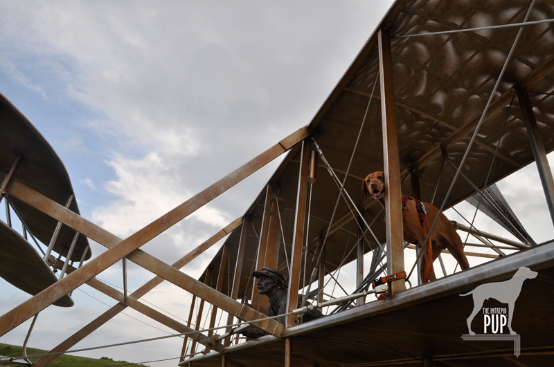
Tavish gets an Orville-eye-view of Kill Devil Hills from Stephen Smith’s life-size sculpture, December 17, 1903.
In March of 1917—more than 13 years after his first flight and just five after his brother Wilbur’s untimely demise from typhoid, Orville got a dog: a St. Bernard named Scipio. (We always knew Orville was a cool guy). Fortunately the Library of Congress has 13 marvelous photographs of Scipio, and it leaves us to wonder: Did Scipio ever sense his owner’s lofty achievements? And could he, too, run faster than a flying Orville?
 Dogging the Details
36° 0′ 51.20″ N, 75° 40′ 4.40″ W
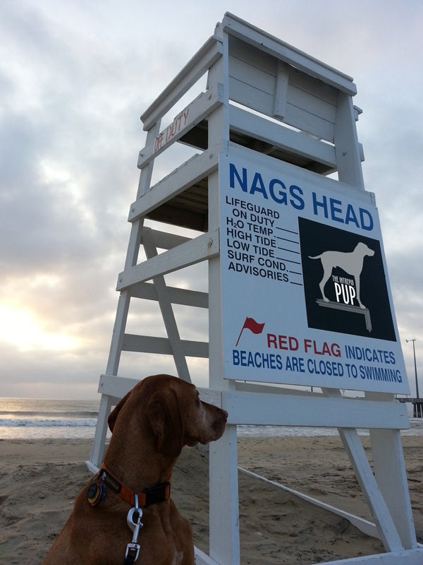
Wright Brothers National Memorial, Kill Devil Hills, North Carolina (milepost 7.5)
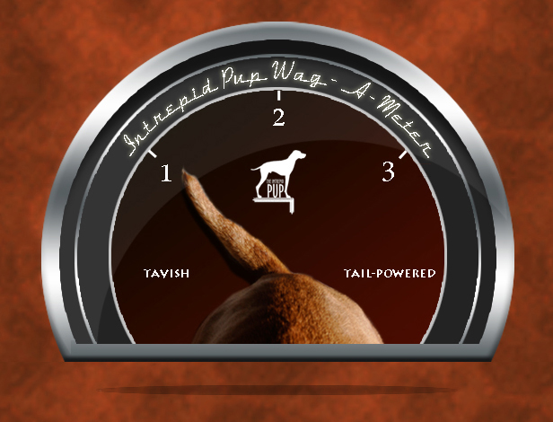
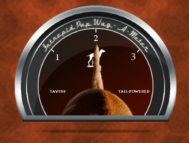
A visit to the Wright Brothers National Memorial scores a “1” on the Intrepid Pup wag-a-meter for providing a fun, outdoor experience on a very historic site. There’s a nominal park entrance fee, but there’s waaaay more to do than just test whether you can outrun the first airplane. Take in everything the park has to offer, and you’ll easily cover approximately 1.5 miles with your dog.
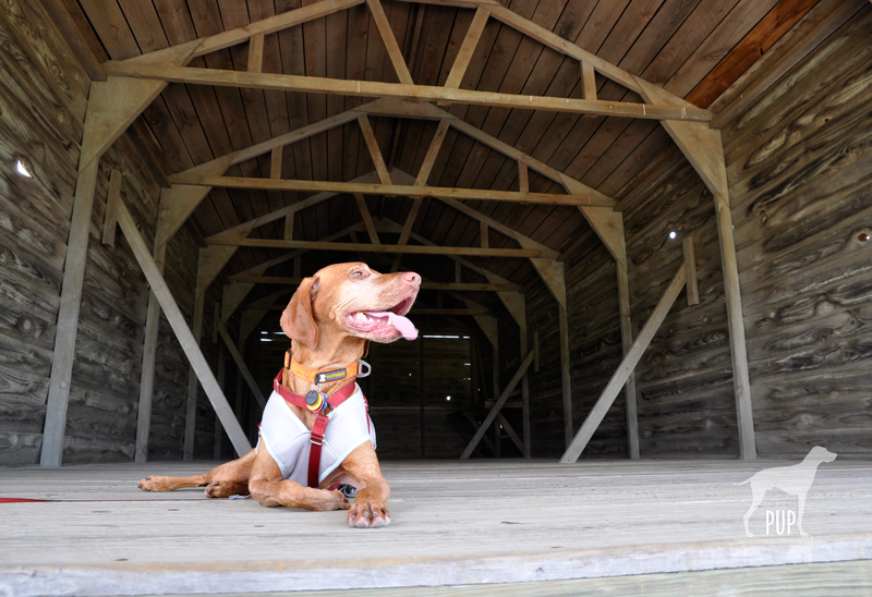
A reconstructed replica of the Wrights’ hangar provides some welcome shade for the Intrepid Pup.
If you’re going in the summer months—as we did—be aware that the grounds are exposed and can get very hot. Bring along water for your pup; there are restrooms and drinking fountains onsite for a refill. Shade is hard to come by, but Tavish found some in the replica of the Wrights’ hangar. Be sure to trek up Big Kill Devil Hill to get a panorama of the park but also a view to the sea. This promontory was where the Wrights logged thousands of glider flights testing their theories on how best to control pitch and yaw. It’s topped by an impressive 60-foot granite shaft erected by Congress and dedicated in 1932. By the time we got to the monument, it was high noon and pretty toasty, so Tavish’s Ruffwear Swamp Cooler ™ Vest provided him extra comfort.

Crowning Big Kill Devil Hill is a monument to the Wright brothers’ crowning achievement, “the conquest of the air.”
Before turning back to further explore the Visitor Center or catch a ranger program, head downhill beyond the memorial. At the apex of the loop road is a five-ton bronze and stainless steel sculpture group by Stephen Smith entitled, December 17, 1903. It captures that exact instant of first flight preserved in a photograph known the world over. In fact, it makes for a pretty great backdrop for taking some photos of your own (see below).
Finally, there are even more places to explore with your pup within easy distance of the Wright Brothers National Memorial. Check out the Intrepid Pup’s earlier post, “Summer Fun: 5 Dog-Friendly OBX Destinations” for a few suggestions!

The hand of “Wilbur Wright” holds the leash that includes the Intrepid Pup in this now-famous scene. Sensing that they’d be successful on December 17, 1903, the Wrights wanted to photograph the instant the flyer left the ground. They set up a tripod, and Orville asked bystander John Daniels if he’d man the camera. (No pressure, there, right?) The rest is history. Better yet? It was the first time Daniels had ever used a camera!


 You see a lot of dogs on the Outer Banks enjoying outdoor activities a-plenty. So at first we were puzzled by the fact that dog-friendly lodging and dining weren’t as abundant. It turns out that many dog-owning OBX vacationers rent beach houses by the week (Sunday to Saturday) so they’re not needing as many hotels and always have the option of cooking in. That being said, there are approximately a dozen pet-friendly overnight accommodations. We stayed at the


 There are two standouts in this spectacle. One is the signature green “tail” pictured above. The other is the Tree of Shame located in the motorcycle resort’s parking lot. This crowd-sourced totem is part whimsy, part rite-of-passage, and part cautionary tale. Basically it’s 20+ years of jetsam—smashed reflectors, blown tires, broken headlights, dented hubcaps, and shorn fenders—lobbed in frustration by those unlucky enough to have been “bitten by the dragon.” The tree is always in flux as pieces get added or otherwise shift among the branches (a nearby sign warns, “CAUTION: Watch for falling parts from Tree of Shame”). It’s also a good reminder that riding the Tail of the Dragon carries an inherent risk; over the past 12 years, there’s been an average of slightly more than two deaths a year.